
Sources for Montgomery Neighbors
Each block source answers a narrow question. GIS establishes which parcels surround an address. The Revenue Commissioner identifies the owners indexed to those parcels. Public civic directories identify an association or city contact, not its full membership. Voter information follows separate Alabama access rules and cannot be treated as a live block roster.
| Source | What it shows about a block | Access |
|---|---|---|
| City GIS parcel and address layers | Lot shapes, nearby addresses, limits, districts, zoning | Free map and ArcGIS services |
| Revenue Commissioner appraisal roll | Indexed owner, mailing address, situs, parcel ID | Public portal or office |
| Alabama voter records | Authorized registration, precinct, and district evidence | Self-lookup or statutory list request |
| Neighborhood Services directory | Association identity, history, and city contact route | Public city directory and staff |
| Probate land index | Recorded covenants, HOA entity, deeds, and liens | Online index, images, or Records Room |
| Reverse city directories | Dated address-to-listed-occupant evidence | Archive or library collection |
An owner record is useful, but it is not a household directory. A mailing address can differ from the property's situs, and relatives or renters may never appear in the title chain. Keep those limits visible in every block table.
Map Montgomery Block Records
The adjacent-parcel method creates a repeatable block search. It begins with one verified address and expands only far enough to answer the question. Montgomery's GIS layers can also show whether a nearby parcel crosses a city limit, voting precinct, council district, zoning boundary, or recognized neighborhood line.
- Search the target address in Montgomery GIS and turn on the parcel or address-point layer.
- Zoom until the target polygon, parcels sharing an edge, and parcels across the street are visible.
- Identify each selected polygon and copy its parcel number without treating the map popup as the final ownership record.
- Open each number in the Revenue Commissioner appraisal system. Record the owner, situs, and mailing address in separate columns.
- Add jurisdiction and neighborhood layers so the correct public office or community group is used.
A buffer tool, when offered by the current viewer, can select a consistent radius. It should not be described as defining who socially counts as a neighbor. For an entire named road rather than the immediate block, use the Montgomery street directory.
Note: The map selects nearby land, while the Montgomery County appraisal record is the official source for indexed property ownership.
Build a Montgomery Block Table
A simple table prevents small mistakes from becoming confident claims. Give each parcel its own row. Preserve the identifier exactly, record the situs as displayed, and copy the owner mailing address into a different field. Add the date checked because appraisal and map data can change after a transfer or correction.
- Parcel or account identifier
- Situs address and unit detail
- Indexed owner name and ownership form
- Owner mailing address, clearly labeled
- Neighborhood, council, precinct, and city-limit layers
- Source URL and date inspected
If the owner's mailing and situs addresses match, that supports possible owner occupancy but does not prove it. A homestead or tax-class clue can add weight when visible. Neither identifies other people in the home. The safest wording is “recorded owner of the parcel,” not “the people who live there.”
Montgomery Neighborhood Directory Contacts
The City Neighborhood Services Department operates the official association directory. Its public material identifies neighborhood organizations and shares association histories or videos. It does not publish a general roster of members. Use the city route to learn which organized group serves an area, how to form one, or which staff member can direct a civic question.
Neighborhood Services
25 Washington Avenue, 5th Floor
P.O. Box 1111
Montgomery, AL 36104
Department Director
334-625-3422
Official association and neighborhood-services route
Resource Specialists
334-625-2737
334-625-2198
Help with neighborhood organization questions
The Neighborhood Services and Association Directory is a public contact path, not permission to reproduce private lists. An HOA may also appear through a recorded declaration or entity name in Probate records, but that filing still does not expose a private member directory.
Montgomery Voter Records by Block
Alabama's individual VoterView tool verifies a known person with first name, last name, date of birth, and a challenge. Its address mode returns a polling place. It does not enumerate people around an address. A full electronic voter list is a separate statutory product under Ala. Code §17-4-38 and must be obtained through the Secretary of State's process.
A lawfully obtained file may contain registered name, residence and mailing addresses, status, precinct, polling place, and political districts. It never reveals a ballot choice. Residence strings also need careful normalization because directional suffixes and apartment labels may differ from the parcel roll. Registration is dated evidence, not real-time proof of occupancy.
Protected voters can have residence and mailing addresses omitted under Ala. Code §17-4-33(b). The Montgomery County Board of Registrars handles registration changes and questions. A block method must never attempt to defeat a protected-address designation or infer a person's location from gaps in the public file.
Note: No match may reflect a move, inactive status, a name variant, no registration, or a lawful address protection.
Montgomery Neighbor Sources Compared
Official rolls and commercial neighbor tools are not interchangeable. The official source has a defined custodian, field meaning, and correction channel. A commercial compilation can be convenient, yet it may combine an old directory, a property owner, and marketing data into one profile without showing when each part was collected.
| Question | Official Montgomery route | Commercial compilation |
|---|---|---|
| Who owns a parcel? | Revenue Commissioner record with parcel ID | May repeat an old owner without a clear date |
| Which lots are nearby? | City GIS parcel and boundary layers | Radius or “nearby” logic may be unexplained |
| Which group serves the area? | Neighborhood Services directory | May confuse an HOA, subdivision, and neighborhood |
| How is an error fixed? | Contact the named public custodian | Use the service's own correction or suppression process |
Start with the source that created the record. If an owner name is wrong, ask the Revenue Commissioner about correction. If a boundary label is wrong, contact GIS. Correcting a source does not automatically update every later commercial copy.
Request Montgomery Block Records
Some useful block records have no browseable public index. City Clerk requests may reach existing code, inspection, zoning, or council records, while the Probate Records Room provides land instruments and older indexes. Ask for a known record, date range, parcel, address, or instrument rather than requesting a new custom roster that the agency does not keep.
The image below comes from the Alabama Secretary of State's public-records request guidance.
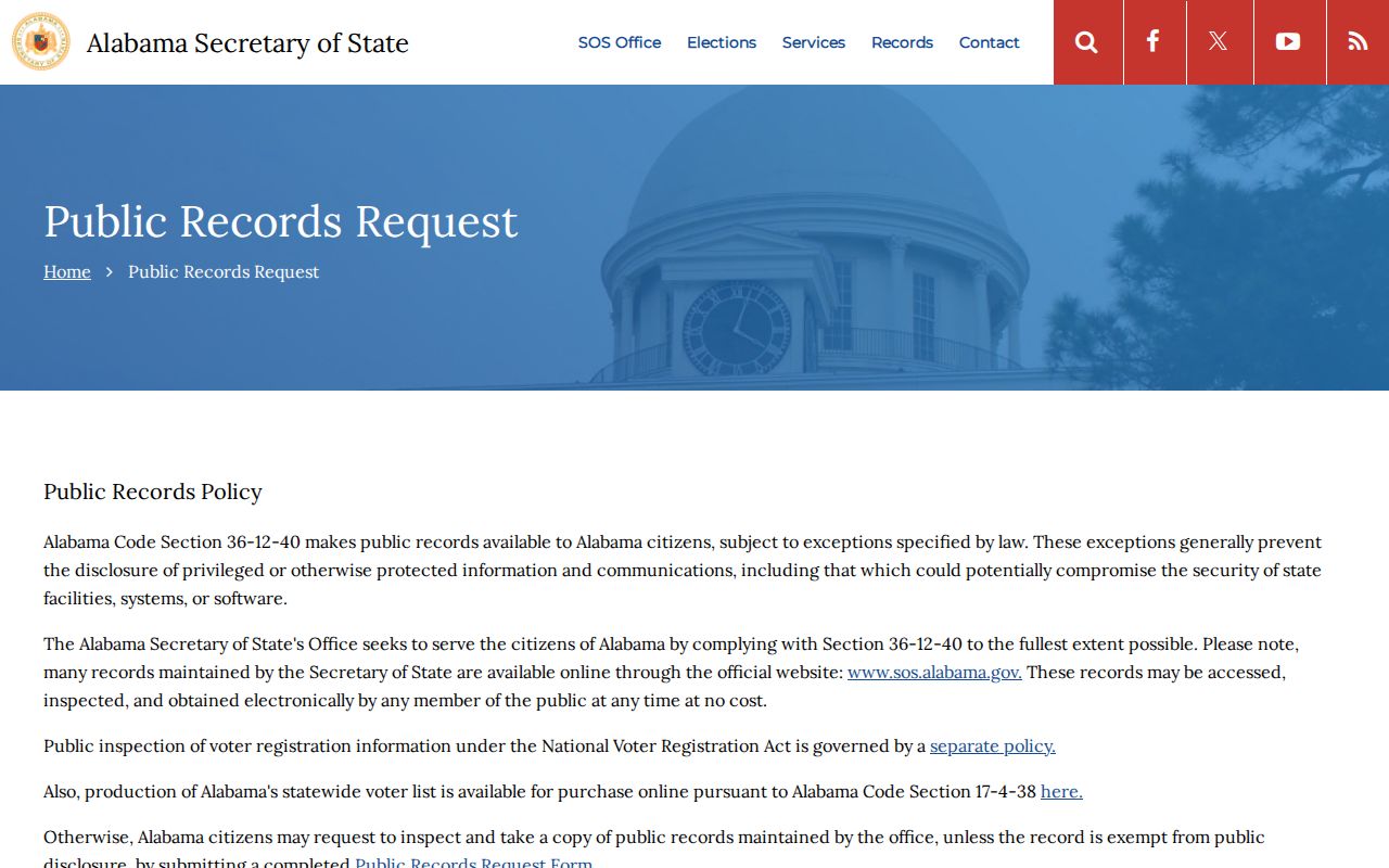
The state page illustrates the formal channel when a Secretary of State record is involved, including voter-list questions. Alabama Open Records Act access generally rests with Alabama citizens and remains subject to exceptions. City requests also require the requestor's full physical address, and fees are assessed before production. These procedures do not override protected voter addresses or create a right to private association, utility, or delivery data.
Free sources should come first: GIS for geography, appraisal for parcel ownership, the association directory for a public civic contact, and the open-data catalog for available datasets. A narrow request is easier for a custodian to identify and less likely to produce unrelated personal detail.
Montgomery Block Directory Through Time
A present block can be compared with reverse or criss-cross directories held by the Alabama Department of Archives and History. Address-first Montgomery editions are documented for 1993 through 1997, 2002, and 2003. Read the addresses in sequence, copy only the listed name for that edition, and confirm it in the alphabetical side of the volume.
Historic comparisons require a boundary check. East and west downtown streets follow different inherited grids, and annexations moved some areas from county-only to city systems over time. Cypress Creek additions occurred in 1896, 1910, and 1927. South Montgomery grew through later staged annexations, including a major Troy Highway addition in 1980.
Reverse directories are snapshots, not full censuses. Some people opted out, moved between canvass and print, or lived in homes listed under another person. Use them to show a dated published connection, then pair them with deeds, maps, or probate evidence when the question is historical.
Privacy for Montgomery Neighbors
The largest misconception is simple: a deed does not name every person living on the land. Neither does a tax roll. Renters, relatives, and private association members often remain absent, while a named owner may receive correspondence in another city or state. Utility accounts, delivery data, and private rosters are not public block directories.
Geographic labels can mislead too. A Montgomery postal address, city limit, neighborhood name, precinct, and council district may overlap without matching. Use GIS to select the correct public office. Avoid turning a map choice into a claim about social ties, and do not publish sensitive facts merely because separate records could be combined.
Lawful use. Use Montgomery neighbor records for civic questions, property research, reconnecting, and personal awareness. Never track, threaten, harass, or expose a protected person.
Good block research stays modest. It distinguishes owners from occupants, keeps dates attached, and uses public community contacts instead of seeking private member names. When a conclusion cannot be confirmed, say what the record shows and stop there.