
Montgomery ZIP Directory Coverage
Montgomery's postal landscape has standard geographic ZIPs, station and post-office-box labels, military routes, and unique state-government codes. The city's GIS layer also reaches county fringe ZCTAs. A ZCTA is a Census approximation of a ZIP-shaped area, not the Postal Service's live delivery file. The compact table groups codes by how they work so that a postal label is not mistaken for a residential district.
| ZIP | Areas Covered | Post Office or Use | Search Note |
|---|---|---|---|
| 36104 | Downtown, Capitol vicinity, Cottage Hill, Old Alabama Town | Downtown station | Standard geographic area |
| 36105 | South Court, Cloverland, southwest, Hope Hull approach | Cloverland station | Extends into southern county geography |
| 36106 | Midtown, Cloverdale, Garden District, Carter Hill | Carolyn station | Standard geographic area |
| 36107 | Capitol Heights, inner east | Capitol Heights station | Standard geographic area |
| 36108 | West Montgomery, Selma Highway corridor | Westside station | Standard geographic area |
| 36109 | Eastbrook, Dalraida, Atlanta Highway vicinity | Eastbrook station | Standard geographic area |
| 36110 | North Montgomery and Boylston | Boylston station | Standard geographic area |
| 36111 | McGehee Estates, Green Lantern, south-central area | Green Lantern station | Standard geographic area |
| 36116 | South and southeast, Woodley and Troy Highway corridors | South station | Major annexation context |
| 36117 | East Montgomery, Taylor Road and eastern growth area | East-side delivery | Large eastern suburban area |
| 36112, 36113, 36115 | Maxwell AFB and Gunter Annex | Military routes | Not ordinary neighborhood directories |
| 36130-36135, 36140-36142 | State agency and tax processing | Unique government routing | Zero-area or institutional codes |
Other Montgomery labels need direct verification. Codes 36119 through 36125 include main-facility, PO-box, station, and special routing uses. Codes 36177 and 36191 are unique or special. The city's broader map also displays fringe codes 36013, 36043, and 36064, yet Cecil, Hope Hull, and Pike Road postal geography should not be called Montgomery city territory without checking the parcel and boundary.
Montgomery ZIP Types Matter
The phrase “Montgomery ZIP” can describe three different things. First are standard delivery areas used by homes and businesses. Second are Postal Service stations and post-office-box routes. Third are special or unique codes for Maxwell, Gunter, Alabama agencies, tax processing, and other high-volume recipients. Only the first group behaves much like a neighborhood area.
That distinction changes how the Montgomery ZIP code directory should be used. A state revenue code does not define a set of nearby households. A Maxwell routing code does not create an open base resident roll. A PO-box code points to mail handling, not the physical site of each box holder. Searchers should classify the code before drawing any geographic conclusion.
- Standard ZIP: ordinary delivery geography that may cover several neighborhoods.
- PO-box ZIP: mail collected at a facility rather than a mapped home area.
- Unique ZIP: a code assigned to one institution or major recipient.
- Military ZIP: specialized routing tied to an installation and its mail rules.
Note: The City of Montgomery's count of 35 ZIP codes includes non-geographic codes as well as standard mapped delivery areas.
Verify Montgomery ZIPs With USPS
The Postal Service is the final authority for the current code assigned to one deliverable address. Neighborhood lists and Census polygons are useful for orientation, but they can lag a routing change or blur a boundary. Enter a complete address when possible. City-and-state lookup is better for discovering possible codes, while address lookup resolves the actual delivery label.
The official USPS city and state ZIP lookup is the manifest source for Montgomery postal verification.
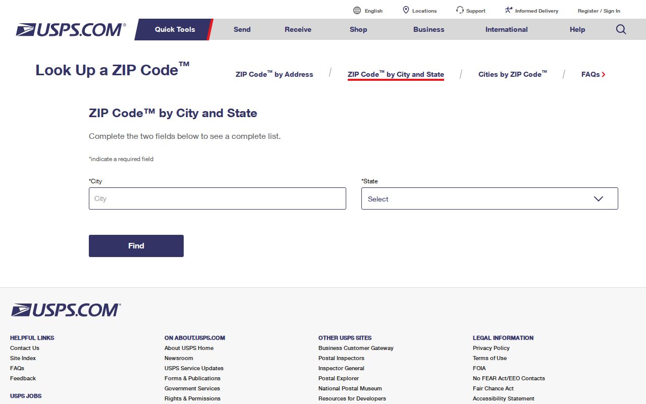
The lookup screen supports a postal answer, not a resident list. Take the verified ZIP back to parcel, GIS, voter, or historical directory records that actually carry the identity clues.
USPS facility evidence names Downtown, Cloverland, Carolyn, Capitol Heights, Westside, Eastbrook, Boylston, Green Lantern, Maxwell AFB, South, Montgomery Main, Lagoon Park, and Shakespeare stations. A station name can help explain routing, but it should not be used as a formal neighborhood boundary.
Montgomery ZIP Labels Changed
Old records can carry a valid address with a label no longer used in the same way. In 2015, USPS consolidated the 36102 and 36103 labels into 36101. It also consolidated 36121 and 36123 label routing into 36120. The delivery destination did not have to move for the printed code to change.
This quirk explains why an old directory export, court filing, obituary, or business record may disagree with current USPS output. Preserve the code as the dated source printed it, then record the modern verified result separately. Do not silently replace one with the other. The older version may be vital when searching an index created before the consolidation.
Insider tip. Search both the legacy and current ZIP labels when a Montgomery name disappears between older and newer databases.
Codes 36102 and 36103 should not be treated as current residential polygons. Likewise, Lagoon Park and Shakespeare station codes reflect facility or service use more than ordinary residential territory. Exact address verification prevents those labels from producing a false block or neighborhood claim.
Finding Montgomery Residents by ZIP
A ZIP-wide resident search has no one official button. The city ZIP layer contains ZCTA geometry but no owner or person fields. The county property system is authoritative for parcel ownership, yet the research did not confirm a stable ZIP filter in its current public interface. Alabama's VoterView verifies a known registrant and is not an open browse-by-ZIP roll. Use the ZIP to narrow geography, then change to a record with person or parcel fields.
- Verify the full street address through USPS and keep the current code.
- Open the city or county GIS and locate the parcel. Compare its location with the ZCTA and city-limit layers.
- Carry the parcel number into the Revenue Commissioner's appraisal record. Label situs and owner mailing addresses separately.
- Use a known name in the proper voter, court, probate, or historical directory source. Do not reverse a person list from the ZCTA map.
Once a postal area has been narrowed to a road, the Montgomery search by street provides the address-level workflow. That step uses parcels and official records rather than assuming that everyone with the same ZIP lives in one district.
Montgomery ZIP and Parcel Fields
The city ArcGIS service can query the ZCTA field and draw ZIP-shaped polygons. Those polygons answer which mapped ZCTA contains a point. They do not identify a parcel owner. The Revenue Commissioner's GIS and Cadastral Mapping division maintains the county parcel layer, which creates the bridge from postal geography to a specific property.
| Field or Control | Record Type | Use in a ZIP Search | Limit |
|---|---|---|---|
| ZCTA | City ZIP polygon layer | Query or display a mapped ZIP-shaped area | No person or owner fields |
| Address | Parcel viewer | Navigate to the physical site | Requires a known address |
| Parcel number | GIS and appraisal | Connect map geometry to the official owner card | Not a household identifier |
| Owner name | Appraisal search | Find parcels held under an indexed name | Owner may live elsewhere |
| Legal description | Parcel and deed record | Stabilize identity across address changes | Not a postal route |
Search Montgomery County GIS online services for the parcel, then compare the physical or situs ZIP with the owner's mailing ZIP. A mailing address is where correspondence goes. It can be elsewhere in Alabama or in another state, so it cannot prove where the owner resides.
Montgomery ZIP Geography Has Seams
Montgomery's streets began with two town plans. New Philadelphia formed the east half of present downtown, while East Alabama Town lay west. Their 1819 merger left streets east of Court Street on a cardinal grid and streets west of Court turned toward the Alabama River. ZIP polygons came much later, so an old “corner” or “between” address needs a historic street table and parcel evidence rather than a modern postal label alone.
Annexation adds a second seam. Cypress Creek territory entered Montgomery in 1896, 1910, and 1927. South Montgomery grew through staged annexations from 1949 into the 1960s, and much of the Troy Highway area joined in a major 1980 annexation. An older address can appear in county records before it appears within city jurisdiction.
These changes are why ZIP, neighborhood, council district, voting precinct, and city limits must remain separate. One street may cross several civic layers even when every envelope says Montgomery. GIS resolves the current jurisdiction; deeds, plats, and dated maps explain the older one.
Montgomery Military and State ZIPs
Maxwell Air Force Base and Gunter Annex add military postal geography to Montgomery. Codes 36112 and 36113 relate to Maxwell operations and mapped geography, while 36115 relates to Gunter Annex. Installation access, transient personnel, and military mail rules mean these codes cannot be handled like a public subdivision list. A postal code does not authorize access to nonpublic personnel information.
State-government routing is equally distinct. Codes in the 36130 through 36135 and 36140 through 36142 ranges serve Alabama agencies and tax processing. They are unique institutional codes, not resident-bearing neighborhoods. A filing mailed to one of them proves contact with a state office, not that a named person lives at the code.
The downtown 36104 area can include ordinary delivery, historic neighborhoods, and the Capitol complex near one another. Keep the institution name, department, street address, and code together. The Montgomery ZIP code directory is most accurate when it describes the function of each code instead of forcing every code into a residential map.
Montgomery ZIPs Versus City Limits
A 361xx address does not prove residence inside Montgomery's corporate limits. Standard delivery areas can cross legal boundaries. PO-box and special codes have no useful residential footprint. The city GIS also shows 36013, 36043, and 36064 because its mapping extent reaches Cecil, Hope Hull, and Pike Road fringes. Pike Road's own named postal facility is direct evidence that a polygon can appear in a Montgomery-operated map without becoming a city neighborhood.
Boundary check. Use the city-limit layer and parcel record before assigning an address to Montgomery city government or a city-held record set.
This is the central myth to avoid. Postal geography sorts mail. Municipal boundaries allocate government authority. County parcels describe land. Neighborhood names express local identity. The layers often overlap, but none substitutes for another.
For a public-record request, send the request to the custodian whose jurisdiction covers the parcel or event. A Montgomery mailing line outside city limits may belong with Montgomery County rather than the city clerk. A state or military ZIP may point to an institution that keeps its own records.
Reading Montgomery ZIP Terms
Postal and map terms are easy to blend. Keep the definitions precise when recording a result from the Montgomery ZIP code directory, USPS, Census mapping, or county parcel search.
- ZIP Code
- A Postal Service routing code. It is designed for delivery, not as a legal city boundary.
- ZIP+4
- The five-digit ZIP plus four digits that narrow delivery to a segment, building, floor, or other route unit.
- ZCTA
- A Census polygon built to approximate ZIP geography for statistics and maps.
- Carrier route
- A group of delivery points assigned to a postal carrier's route, not a resident directory.
- Situs address
- The physical location of a parcel, which may differ from the owner's mailing address.
Write down the source and date with each code. USPS confirms delivery. The city GIS shows mapped ZCTA context. County appraisal identifies the parcel and indexed owner. Historical directories preserve the label used in their own year. Keeping those roles distinct makes ZIP-based research reproducible and protects against false claims about who lived inside a line.