
Walk a Montgomery Street Record
No official Montgomery household list can be browsed street by street. The sound substitute is a chain of public records. Start with geography, identify the legal parcel, and then follow the owner and document references held by the proper custodian. This order matters because an address may sit in a Montgomery postal area without lying inside the city boundary. It also prevents a name from being attached to the wrong lot.
- Enter the street address in the city or county map. Confirm the address point, parcel shape, and jurisdiction before copying the parcel identifier.
- Move that identifier to the Montgomery County Revenue Commissioner appraisal record. Record the owner, situs address, mailing address, and legal description as separate fields.
- Use nearby parcel polygons to continue along the street. Do not treat map proximity as proof that the named owners occupy those homes.
- Carry each owner name and legal description into the Probate land index. The deed chain can show title changes even when an older instrument lacks a useful street address.
- Add permit, voter, and reverse-directory evidence only for the dates and access rules each source supports.
The result is an evidence table, not a live roll of all occupants. Montgomery street directory research becomes more reliable when every statement is labeled as ownership, registration, a dated publication, or a permit event.
Montgomery Street Records Compared
Address-keyed sources overlap, but none replaces the others. The street directory gains strength when the same parcel identifier, legal description, or dated name appears across separate official systems. Online tools provide a fast start. Counter service, microfilm, mail, fax, and a focused records request remain important when a web index ends.
| Address source | Montgomery keeper | Useful result | Access route |
|---|---|---|---|
| Parcel and appraisal roll | Revenue Commissioner | Owner, situs, mailing address, parcel, values | Public portal or appraisal office |
| GIS layers | City GIS and county mapping | Parcel shape, zoning, limits, district context | Free map and ArcGIS services |
| Recorded land instruments | Judge of Probate | Deeds, mortgages, liens, releases, book and page | Free index; account, counter, or microfilm for images |
| Permit and code files | City Clerk and Inspections | Dated work, inspections, occupancy, zoning action | Citizen Access or address-specific request |
| Voter information | Secretary of State and Board of Registrars | Authorized registration and precinct evidence | Self-verification or statutory list request |
| Reverse directories | ADAH and local library collections | Listed occupant at an address in an edition year | Digital, reading-room, or library access |
A current owner may live elsewhere, and a listed voter may have moved. Treat dates and record roles as part of the answer. The full named-street chain belongs here; research centered on only one modern person is better handled through the Montgomery resident lookup.
Search Montgomery Streets by Address
The Montgomery County Appraisal page links the Parcel Viewer and property-tax search. Begin with the situs, meaning the physical location of the parcel. Copy the parcel or account number before trying name variants. The same owner may hold several lots, while a street spelling may vary between the map and a recorded instrument.
| Search control | Type | Requirement | Best use |
|---|---|---|---|
| Owner name | Text | One search mode | Find parcels held by a person, estate, or entity |
| Property address | Text | One search mode | Open the parcel at a known situs |
| Parcel/account number | Text | One search mode | Bridge map, appraisal, and tax records |
| Map identify | Interactive | Optional | Select lots while moving along a street segment |
A parcel card should keep owner mailing and property addresses distinct. Land value, improvements, tax class, an exemption indicator, and a map link may add context when they appear. A homestead clue can support owner occupancy, but it never identifies every resident.
Insider tip. The parcel situs identifies land; the owner's mailing address only identifies where tax correspondence is sent.
Map Montgomery Streets in GIS
The city's ArcGIS service directory exposes a broad set of geographic layers. Those layers include parcels, address points, streets, zoning, annexations, city and county limits, council districts, precincts, flood zones, historic districts, schools, transit, and neighborhood boundaries. Search by address, owner, or parcel number, then zoom until the individual lot shapes are clear.
The image below comes from the official Montgomery GIS data services.
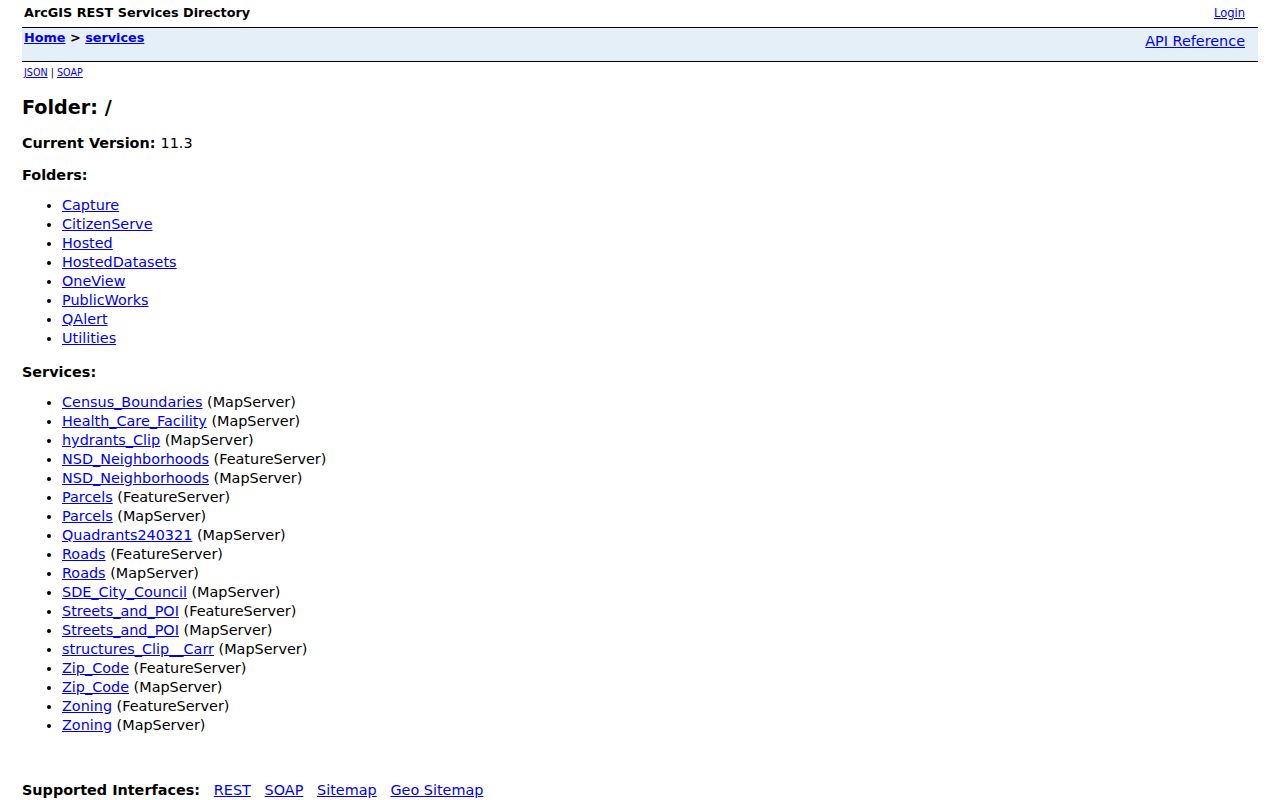
The service view shows why a map is a selection tool rather than proof of residence. Click or identify the parcel, preserve its ID, and use the Revenue Commissioner record to interpret ownership. If the current viewer offers a buffer tool, a modest buffer can define a repeatable study area. It does not create a social or legal definition of a neighbor.
Note: A Montgomery mailing line, city limit, voting precinct, council district, and neighborhood label may describe different geographic layers.
Decode Montgomery Address Records
Several terms recur in a by-address search. Keeping them distinct prevents common errors when a street number changes or an owner receives mail elsewhere.
- Parcel
- A mapped unit of land with an identifying number used across appraisal, tax, and GIS systems.
- Situs address
- The physical street location assigned to the property, separate from the owner's mailing address.
- Plat
- A recorded map that divides a tract into lots, blocks, streets, or easements.
- Legal description
- The deed's stable land description, often by subdivision and lot or by metes and bounds.
- Criss-cross directory
- A directory arranged by street and address rather than only by a person's surname.
A legal description is often the best bridge across time. Postal labels and street wording can shift, but the recorded lot or tract remains tied to the title chain. The directory entry is weaker evidence because it is a dated publication snapshot.
Follow Montgomery Streets Through Deeds
The Montgomery County Judge of Probate computer index covers real-property deeds, mortgages, judgments, liens, releases, and assignments from June 1970 forward. The official land-record directions require party names in last-name-first-name order without a comma. A percent sign before a fragment works as a wildcard. Group Type and beginning or ending dates can narrow a slow search.
Start with the acquisition deed for today's owner. Note its grantor, grantee, legal description, and book/page. Search the grantor as a grantee in an earlier transaction, confirm the same land description, and repeat. The gray plus control expands a party result. A linked page number, not the button marked View, opens the image route. This odd interface detail can save time.
The index is free. Online images require a monthly account, while printed web images carry a per-image charge. The Probate Records Room provides public computers, deed-book images from book 400 forward, microfilm, bound indexes, staff help, and counter copies. Once the chain crosses the online boundary, those in-person sources are the correct fallback.
Note: An older deed may omit the modern street number, so carry the parcel's legal description through every Montgomery title link.
Montgomery Permit Records by Street
Permit and code records can date physical changes that a deed will not describe. Search the Montgomery Citizen Access permit portal first. Depending on the retrieved file, useful details may include permit dates, work descriptions, an applicant or owner, contractors, valuations, inspections, and certificates. Some portal actions may require an account, and the research does not establish a complete public start year.
The following image comes from the official permit and inspection search.
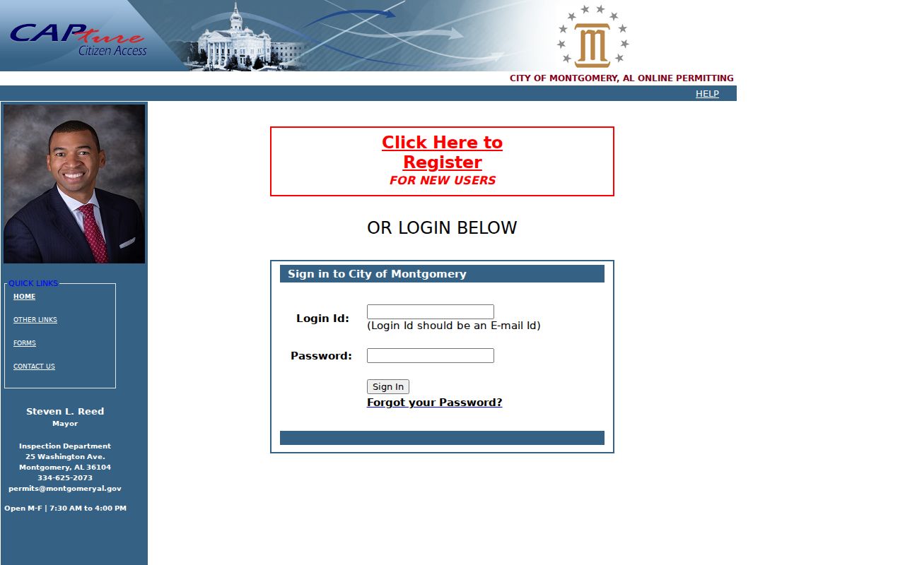
The screen is the free first stop, but it is not the whole access channel. The City Clerk accepts the full request form in person, by mail, or by fax. Since April 7, 2025, every request is charged and one lacking the requestor's full physical address is denied. Address-specific certificate of occupancy, building-code violation, inspection, zoning or variance, and special-exception reports are posted at $25 each; an assessment letter is $75. Routine production may take 25 business days.
Before ordering several reports, exhaust the GIS, assessment, permit, and open-data sources. Then request the one existing record that answers the unresolved question and wait for the city's cost notice before paying.
Montgomery Street Voter Evidence
Alabama's VoterView is not an open street directory. It verifies a known voter's registration using first name, last name, date of birth, and a challenge. A separate address mode finds a polling place, not people at that location. A match may show registration status, polling place, and political districts, but never ballot choices.
A full voter list follows a different route under Ala. Code §17-4-38. The Secretary of State provides electronic lists to applicants, and the posted schedule prices them per voter record. For a Montgomery street study, a lawful request should specify Montgomery County, identify only the needed fields, and keep residence separate from mailing address. Directional suffixes and apartment designators must be normalized before rows are compared.
Protected addresses are omitted for qualifying participants and officials under state law. A missing name can mean unregistered, recently moved, inactive, listed under a variant, or protected. Only the Montgomery County Board of Registrars can correct the official voter file.
Montgomery Streets Cross Old Boundaries
Downtown Montgomery preserves two rival town plans. Streets east of Court Street follow a cardinal grid, while streets west of Court turn toward the Alabama River. The seam dates to the merger of New Philadelphia and East Alabama Town. An old reference such as a corner or between-streets address may therefore require a period map and legal description, not a modern pin alone.
Annexation adds a second problem. Cypress Creek territory entered Montgomery in 1896, 1910, and 1927. Southern Boulevard, Narrow Lane Road, and Woodley Road areas were added in stages from 1949 through the 1960s, with much of the Troy Highway area joining in 1980. A parcel may first appear in county-only records and later in city permit or district layers.
This Montgomery street directory must also respect ZIP geography. PO-box, military, state-agency, and ordinary delivery codes do not define municipal limits. Confirm the parcel in GIS before deciding which office owns the relevant record.
Note: No authoritative source found a blanket Montgomery County courthouse-record loss, so never invent a fire gap when an index fails.
Montgomery Streets in Reverse Directories
Historical criss-cross editions supply the address-to-name move that modern owner rolls cannot. The Alabama Department of Archives and History identifies Montgomery address-first cross-reference editions for 1993 through 1997, 2002, and 2003. Read the street sequence around a target number, then confirm a listed person in the alphabetical section and note the publication year.
A reverse directory is not a complete household census. Publication lag, opt-outs, abbreviations, apartments, and uneven collection can omit people. Yet a dated listing can place a named subscriber or householder near an address and help bridge a gap between deeds, permits, and later records. For the collections and their broader year runs, use the Montgomery city directories.
When an address fails, try the old legal description, nearby cross streets, and period map. The 1859 directory used compact terms such as “h” for house and “bds” for boards. Later cross-reference books have their own abbreviation keys, which should be read before a household inference is made.
Limits of Montgomery Street Directories
A deed names title parties, not everyone who lives at a property. The appraisal roll has the same basic limit. It may name an estate, trust, company, or owner who receives mail outside Montgomery. Renters, relatives, guests, and other household members often leave no public address-keyed record at all.
Utility and delivery customer data are not public resident rolls. Driver and vehicle address information is restricted by federal law. Voter protections can remove residential and mailing addresses from public lists, while private association rosters should remain private. Commercial compilations may merge old directories, marketing files, and public records, but they can be stale or attach a person to the wrong parcel.
Lawful use. Use Montgomery address records for legitimate personal research, property history, and civic understanding. Never use them to track, harass, intimidate, or defeat an address protection.
Label each conclusion by its true strength: recorded owner, mailing destination, registered voter, permit applicant, or person listed in a dated directory. That discipline keeps a street directory useful without pretending that public records reveal a complete household.