
Montgomery Previous-Resident Source Eras
Each record answers a different part of the address question. The appraisal roll starts in the present. The deed index moves through title parties, while cross-reference books name listed occupants at an address. Census schedules provide periodic household snapshots. Maps and permit files date changes to the site. Choosing the source by era avoids forcing a modern portal to answer an old question.
| Source | Years it covers | Where held | What it can show |
|---|---|---|---|
| Current appraisal and tax roll | Current; online historical cutoff not stated | Montgomery County Revenue Commissioner | Owner, situs, mailing address, parcel, assessment |
| Real-property computer index | June 1970 to present | Judge of Probate online and Records Room | Deeds, mortgages, liens, book and page |
| Deed books and older indexes | Before the online index; book 400 forward images on room computers | Probate Records Room | Earlier title links and legal descriptions |
| Cross-reference directories | 1993–97, 2002, 2003 | ADAH | Listed occupant by address |
| Montgomery city directories | Documented holdings from 1859–60 to July 2007, with gaps | ADAH and Montgomery Room | Names, address clues, spouse and occupation notes |
| Federal census schedules | Released through 1950 | NARA and research libraries | Household members and relationships at an enumeration date |
| Sanborn maps | 1884 through later corrections to 1950 | Library of Congress | Building footprint, material, lot and street context |
Begin with the newest reliable source that overlaps the target period, then work backward one link at a time. For a recent transfer, the parcel and deed route is strongest. For the late twentieth century, cross-reference books add occupants. For an older Montgomery address, directory and census evidence often becomes the main name trail, with deeds anchoring the land itself.
Start Montgomery Records at the Parcel
The Montgomery County Appraisal page links the Parcel Viewer and tax search. Use the physical address to capture the parcel or account number, current indexed owner, situs address, owner mailing address, and legal description. A situs address marks the land's location. A mailing address marks where tax notices go. A mismatch may be useful, but it does not establish who occupied either place.
The parcel identifier and legal description are more durable than a street label. Save the subdivision, lot, block, or metes-and-bounds wording exactly. That text carries the research across a changed street name, a shifted number, or an annexation. It also keeps two similar street addresses from being merged.
Note: Owner records identify title, not every past resident, so directory and census evidence must supply the occupant layer.
Walk Montgomery Deed Records Backward
The Judge of Probate's Records and Recording service indexes real-property records from June 1970 forward. Names are entered last name first name with no comma. A percent sign before a fragment works as a wildcard. Group Type and date controls can trim a long result. Expand the gray plus beside a party, then click the linked page number to reach an image. The button marked View does not open it.
- Copy today's indexed owner, parcel number, and full legal description from the appraisal record.
- Find that owner's acquisition deed and record its grantor, grantee, date, instrument type, and book/page.
- Search the seller as a grantee to locate the deed by which that person acquired the same legal parcel.
- Repeat the link, matching the legal description each time instead of relying on the street address alone.
- When the chain crosses June 1970, continue through the Records Room's bound or microfilmed indexes and deed books.
Index searches are free. Web images require a $10 monthly account, and prints cost $0.25 per image. The courthouse counter offers copies at $1 per page and certification at $2 per document. A paid image or certified copy is not always needed for a first pass; the free index plus book/page can define the next step.
- Grantor and grantee
- The grantor transfers an interest; the grantee receives it.
- Chain of title
- The linked sequence of recorded transfers affecting the same parcel.
- Legal description
- The lot, block, subdivision, or boundary text that identifies land apart from its mail address.
- Instrument
- A recorded document such as a deed, mortgage, lien, release, or assignment.
Earlier Montgomery Records Stay on Microfilm
Online access is not the full Montgomery record. The Probate Records Room is in the basement of Courthouse Annex III at 101 South Lawrence Street, with an entrance at Washington and Lawrence. It provides staff help, public computers, and microfilm readers on weekdays from 8 a.m. to 5 p.m. Deed-book images from book 400 forward are available on its computers. Earlier links rely on direct and reverse grantor-grantee indexes, bound books, and microfilm.
The ADAH County Records on Microfilm database is the statewide inventory for series held on film.
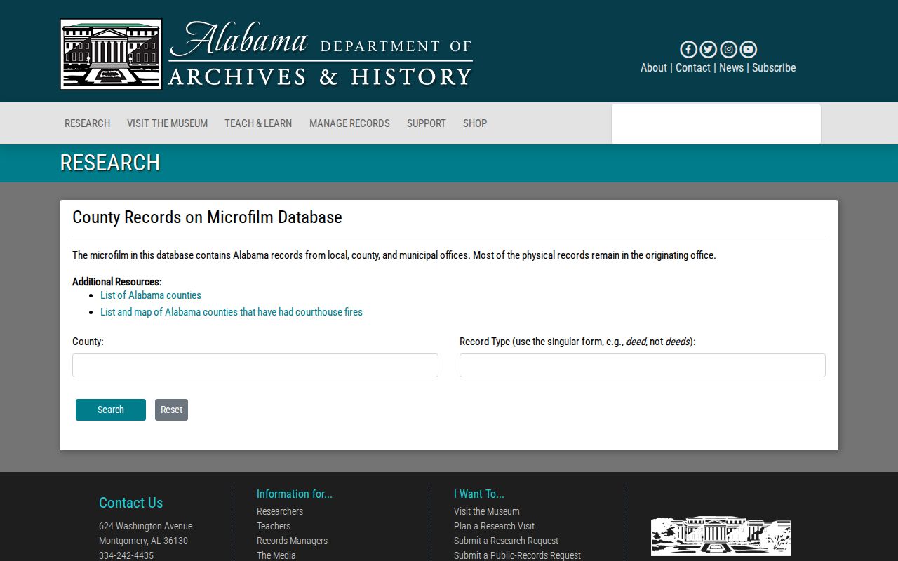
The database helps identify a record type and date span before a visit, but most originals remain with the office that created them. The county archive inventory also lists real-property books from about 1941 through 1986, tract material, tax-exemption indexes, older marriage books, and a 1908 registered-voter list. Ask about one named series instead of assuming every old record has been scanned.
No authoritative source reviewed identifies a blanket Montgomery County courthouse-record loss. The 1849 fire destroyed the first state capitol in Montgomery, not a proved set of county deed books. That myth can send a previous residents search in the wrong direction. A gap must be checked against the specific series and custodian before it is called destroyed.
Keep Montgomery Address Changes Aligned
Historic Montgomery addresses can fail in a modern map for more than one reason. The present downtown joined two differently aligned town grids. East of Court Street, streets follow a cardinal grid; west of Court, they turn toward the Alabama River. Early directory entries often use “corner,” “between,” or a side of the street rather than a current number. A present-day pin alone cannot resolve that wording when tracing previous residents.
Annexation adds another break. Cypress Creek additions occurred in 1896, 1910, and 1927. South Montgomery grew into city systems in stages from 1949 through the 1960s, followed by a large Troy Highway addition in 1980. A property can therefore shift from county-only records to city files while staying on the same land.
Montgomery address tip. Carry the legal description, parcel outline, old street wording, and jurisdiction date together before deciding two records describe the same site.
Find Montgomery Past Residents by Address
Deeds establish title parties. They do not list every person who lived at a property. The address-first layer for previous residents comes from cross-reference directories held by the Alabama Department of Archives and History. The documented Greater Montgomery, Prattville, Wetumpka and Surrounding Area series covers 1993 through 1997, followed by Montgomery cross-reference editions for 2002 and 2003.
A cross-reference directory arranges published entries by street and number rather than by surname. Search the exact address and nearby numbers, then check the ordinary alphabetical listing for name detail. Record the edition date because a directory is only a snapshot. For earlier decades, start with a known name in the alphabetical volumes, then use their street sections where available. The collections and exact runs are detailed on the Montgomery city directory page.
ADAH's early digital set includes 1859–60, 1866, and 1878. Physical holdings extend, with gaps, to July 2007. The archive does not claim one publisher for all later volumes, so title-page evidence should control any attribution. A missing edition or entry may reflect a publication gap, variant spelling, omission, or a move.
Pair Montgomery Directories With Census Records
Federal census schedules supply the household facts a deed lacks and a short directory line may omit. The latest public population schedule is 1950 under the 72-year rule. Use a directory near 1900, 1910, 1920, 1930, 1940, or 1950 to locate the person and address, then compare the matching census. The census can show names, ages, relationships, and birthplace clues on its enumeration date.
The process works best as a dated sequence:
- Copy the directory entry and edition year, including spouse, occupation, and street wording.
- Locate the matching census household by name, place, and other known facts.
- Compare each named person rather than accepting a surname match alone.
- Return to the next directory edition to track a move or a change in household listing.
- Use an obituary or probate file to test a death, kinship, or estate transition.
An enumeration district is the geographic area assigned to a census taker. When an address search fails, maps and district descriptions can narrow the correct set of pages. Directory evidence helps bridge the years between censuses, but neither source gives a live statement of current occupancy.
Date Montgomery Address Records Carefully
Montgomery Sanborn maps show building footprints, materials, lot relationships, and changes across editions. The documented set includes 1884, 1888, 1894, 1900, 1910, and corrected sheets into 1950. A map can show that a building existed by a given survey or changed shape later. It cannot name the resident. Pair it with a directory, census, or deed from the same period.
City permit, inspection, code, zoning, and certificate files can add construction milestones. The Citizen Access permit gateway is the free first check. If the needed record is not exposed, the City Clerk accepts a specific written request in person, by mail, or by fax. Since April 7, 2025, many address reports cost $25 each, while an assessment letter costs $75 per address.
Exhaust the free parcel, GIS, permit, and open-data routes before ordering several reports. Ask for one existing record with a clear address and date range, wait for the cost notice, and do not send payment early. The exact contents depend on the file returned, so a named applicant or contractor should be treated as a dated project clue, not proof that the person lived there.
Close Montgomery Resident Trails With Probate
An obituary, cemetery entry, or estate file may explain why previous residents disappear from an address. The Montgomery County Probate Court's online services include probate case records, while original files and certified copies remain with the court. Estate dockets may identify a personal representative, heirs, dates, and property tied to the proceeding. Each address is historical evidence from the filing, not a current contact promise.
ADAH's Montgomery vertical files add surname-arranged family material and newspaper clippings, especially from the 1940s through the 1970s. The Montgomery Advertiser and Alabama Journal can supply obituaries, legal notices, and move reports. If a likely relative appears, verify the link through a death certificate, probate record, census, or another independent source.
ADAH is also a FamilySearch affiliate library and can display some images that the open web cannot. Its paid remote request covers one surname and up to four sources, includes up to 20 copies, and states a two-to-three-week turnaround. That option is most efficient after the parcel, deed, and directory trail has narrowed the name and era.
Use Montgomery Previous-Resident Records Lawfully
Previous residents research can involve living people as well as the dead. Keep private contact data out of notes shared in public. Do not try to defeat an address-confidentiality program, obtain closed records by deception, or use a historical clue to follow or harass someone. Public access to one deed or directory line does not grant a right to misuse it.
Lawful use. Use Montgomery previous-resident findings for family, estate, historical, or civic research, and confirm sensitive conclusions with the responsible custodian.
Preserve source dates when identifying previous residents. A parcel card is current only for its displayed assessment cycle. A directory reflects its publication period. A deed reflects the recorded transaction, not the full household. A census reflects one enumeration date. When the sources conflict, report the conflict and seek another independent record instead of choosing the most convenient name.